Real-world mobility evidence

See the street as it moves.

Boreal helps researchers, cities and mobility innovators understand how people, vehicles and infrastructure interact in real conditions.

With Urbometry, complex street interactions become structured evidence for research, evaluation and validation.

SYNC
sensor streams
on one timeline
FIELD
moving-road-user
perspective
EVENTS
interactions
made comparable
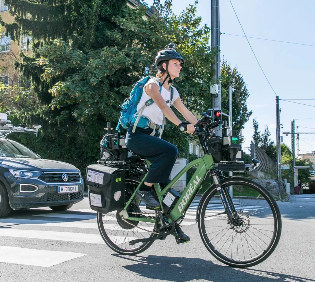
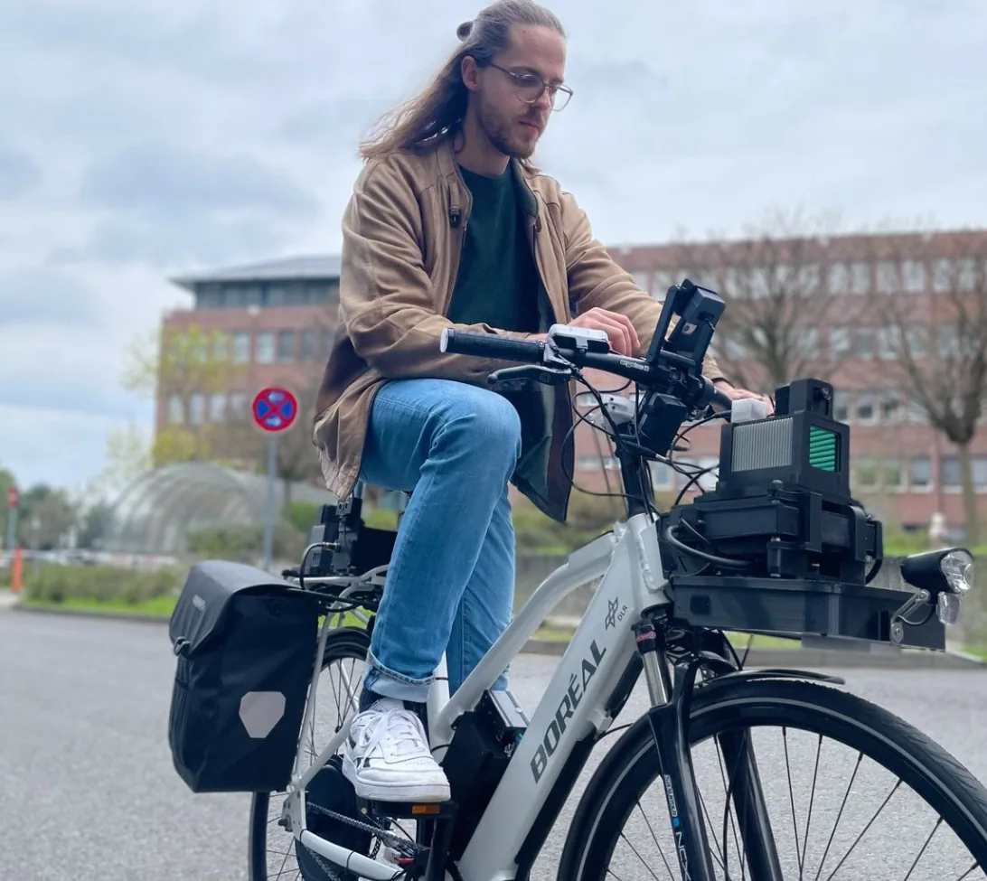
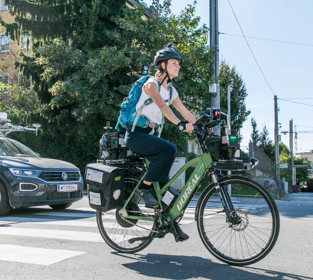
Boreal sensor-equipped e-bike used for active mobility measurement Boreal Holoscene platform
Scroll to examine

Why Boreal

Understand what is actually happening on the street.

New vehicles, services and infrastructure are entering increasingly complex public spaces. Questions about safety, behaviour and performance need evidence from the conditions in which change occurs.

Boreal measures mobility from within the moving environment. It captures how road users interact with one another and with the infrastructure around them—then makes those interactions available for analysis.

ObserveSynchronizeReconstructCompare

Applications

Start with the question that matters.

Whether the decision concerns a street, a service or a vehicle, the measurement approach follows what you need to understand.

01 / RESEARCH

Human behaviour

Understand what road users experience and do.

Study how cyclists and other road users respond to vehicles, infrastructure and changing traffic conditions.

  • How does a cyclist respond to an approaching vehicle?
  • What happens during an overtaking or avoidance event?
  • How does infrastructure influence behaviour?
03 / VALIDATION

Vehicles & services

Demonstrate performance in real operating conditions.

Compare a new concept with an existing reference and examine how real-world operation differs.

  • Road-space use
  • Interaction with other road users
  • Manoeuvring and trajectories
  • Contextual performance

A different point of view

From street interaction to structured evidence.

Traditional traffic sensing usually observes a location. Vehicle telemetry usually observes a vehicle. Urbometry observes the evolving interaction around the moving road user.

See the measurement method
OBSERVED EVENTURB-17
  1. 01

    Cyclist approaches a parked vehicle

  2. 02

    Cyclist changes trajectory

  3. 03

    Vehicle approaches from behind

  4. 04

    Passing event occurs

  5. 05

    Cyclist returns to previous trajectory

Urbometry

A platform for real-world mobility measurement.

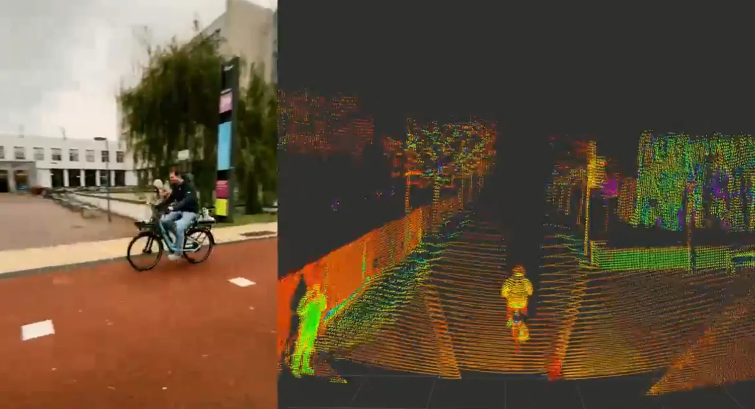
Urbometry connects field measurement, synchronized data and interaction reconstruction into one evidence workflow.

01CaptureObserve the moving environment.
02SynchronizeBring sensor streams onto one timeline.
03ReconstructIdentify trajectories and context.
04StructureTurn continuous data into events.
05CompareMeasure change against a baseline.
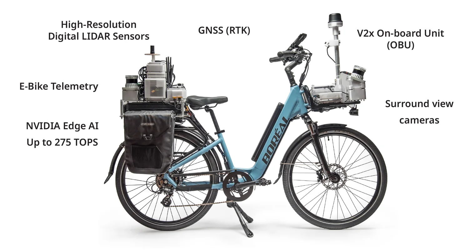
Diagram of the Boreal Holoscene sensor-equipped bicycle platform

Urbometry

Measurement from the moving environment.

Drawing on Boreal’s Holoscene platform, field measurement combines complementary sensing, positioning and motion data. The result is a shared, time-aligned view of the road-user environment.

  • Sensor-rich active-mobility telemetry
  • Precise time synchronization
  • Data handling designed around privacy

Project stories

Evidence in use.

Selected projects from Boreal’s public work show how a sensor-rich active-mobility perspective supports research, validation and safer streets.

Boreal sensor bike used in the Salzburg Research Bike2CAV project
Salzburg Research

Bike2CAV

Cooperative detection of collision risks and non-distracting warning concepts for vulnerable road users.

View project source
Urban traffic digital twin project illustration for DLR SAVENoW
DLR

SAVENoW

Data for a digital twin of urban traffic, supporting the study of traffic safety, emissions and efficiency.

View project source
TU Delft SenseBike in an urban research context
TU Delft

SenseBike

Naturalistic cycling data and semantic mapping to help identify unsafe environments for cyclists.

Source: Boreal Bikes public project description
Boreal smart sensor bike at the Technical University of Munich
TUM

STADT:up

Real-world experiments on cycling behaviour, active mobility and road safety.

Visit TUM

Publicly shown in Boreal’s mobility ecosystem

Salzburg Research TU Delft Technical University of Munich DLR

Method

Baseline.
Measure.
Compare.

Many mobility questions become clearer when they are structured around a reference.

01

Establish the baseline

Understand existing conditions.

02

Introduce the change

A vehicle, service, infrastructure design or operational concept.

03

Measure again

Capture comparable real-world conditions.

04

Build evidence

Identify how behaviour, interactions and operating conditions changed.

Measurement study brief

Frame the right evidence before the fieldwork starts.

Download a concise introduction to the questions, baseline and measurement choices that shape a real-world mobility study.

PDF4 pagesEN

The PDF downloads immediately and your email app opens with a ready-to-send request. No marketing consent is required.

Start with a question

What do you need to measure?

Whether you are validating a mobility concept, evaluating an intervention or studying road-user behaviour, Boreal can help define the evidence needed and how it can be captured.

This form validates your details and opens your default email client; it does not send data through this website.

Privacy settings

No analytics service is configured in this preview. If analytics are enabled when this site is deployed, it will only load after you consent.