
Infrastructure evaluation
Evaluating infrastructure through overtaking measurements
On a street with limited space for cycling infrastructure, measurements helped researchers assess how different road markings affected the way drivers overtook cyclists.
- Location
- Nußdorferstraße, Salzburg, Austria
- Measurement dates
- June and September–October 2025
- Research partner and operator
- Salzburg Research
- Boreal contribution
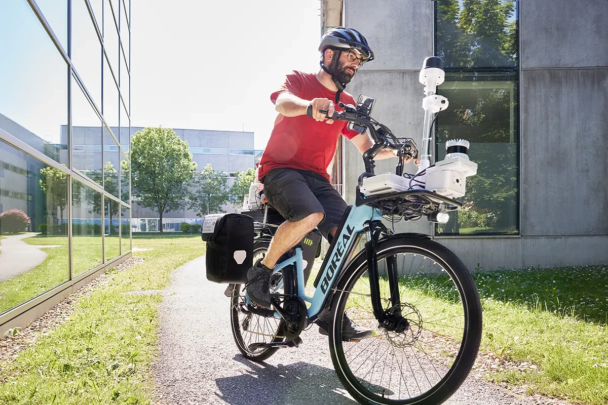
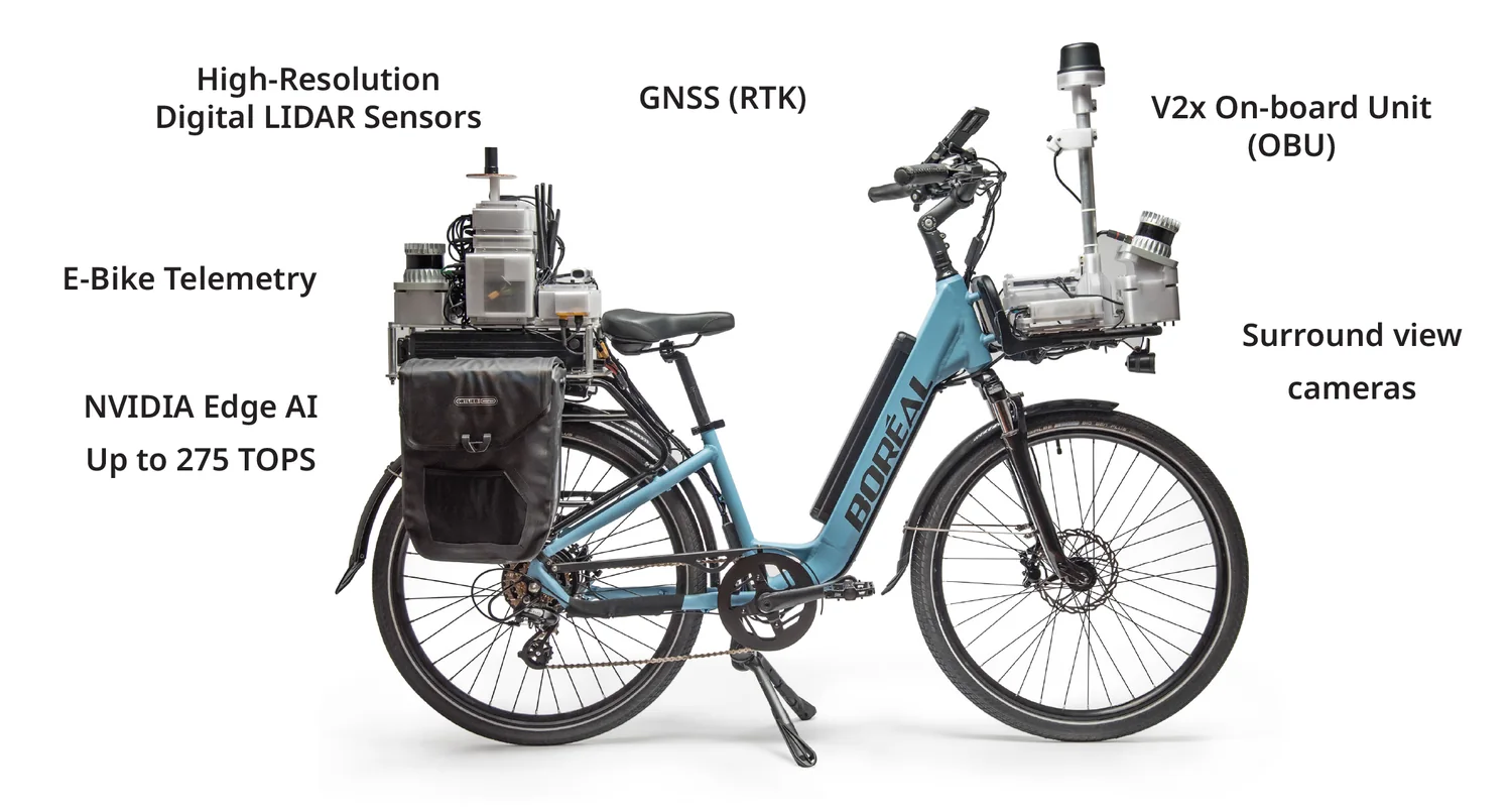
- Holoscene research bicycle sensing platform
01 / Research context
The question
The Nußdorferstraße Living Lab compared wide advisory cycle lanes with a narrow central carriageway against large bicycle pictograms and sharrows. Researchers examined overtaking clearance and the influence of traffic conditions, alongside road users’ perceptions of the treatments.
Living Lab: zukunftswege.at, with con.sens mobilitätsdesign, commissioned by the City and State of Salzburg
02 / Research context
Boreal’s contribution
Salzburg Research operated a Holoscene research bicycle equipped with LiDAR, cameras and additional sensors. The platform captured overtaking events in three dimensions, providing the measurement basis for the research team’s analysis.
03 / Measurements & findings
What the study found
Researchers recorded and analysed 356 overtaking manoeuvres. Reported clearances increased with both treatments, although phase-two medians remained below the intended 1.5 metres: 1.12 metres in the wide-lane section and 1.05 metres in the pictogram/sharrow section. Oncoming traffic influenced clearance; some drivers waited behind the bicycle until opposing traffic had passed.
The wider evaluation received 442 responses. Among cyclists, 60% felt safer with the wide advisory lanes and 53% with the pictogram/sharrow treatment.
- 356
- Overtaking manoeuvres recorded and analysed
- 1.12 m
- Phase-two median · wide advisory lane section
- 1.05 m
- Phase-two median · pictogram/sharrow section
Phase-two medians remained below the intended 1.5 metres. Results reported by Salzburg Research.
04 / Practical value
From measurement to a decision
The combined findings supported a recommendation to extend the wide advisory lane treatment along Nußdorferstraße. The case shows how recorded interactions and user feedback can reveal both improvement and remaining problems, giving planners a basis for deciding what to retain or adjust.
Sources & image credits
- Living Lab description and attribution to the Holoscene bicycle (opens in a new tab)
- Published evaluation summary in English (opens in a new tab)
- Full evaluation report (opens in a new tab)
Image supplied by Boreal Bikes. Sensor-equipped Boreal research bicycle for infrastructure-evaluation research.
Start with a question
Discuss a study
What should change when a street design changes? Boreal can help define the interactions and measurements needed to evaluate that question.
Discuss a study